Estuary model
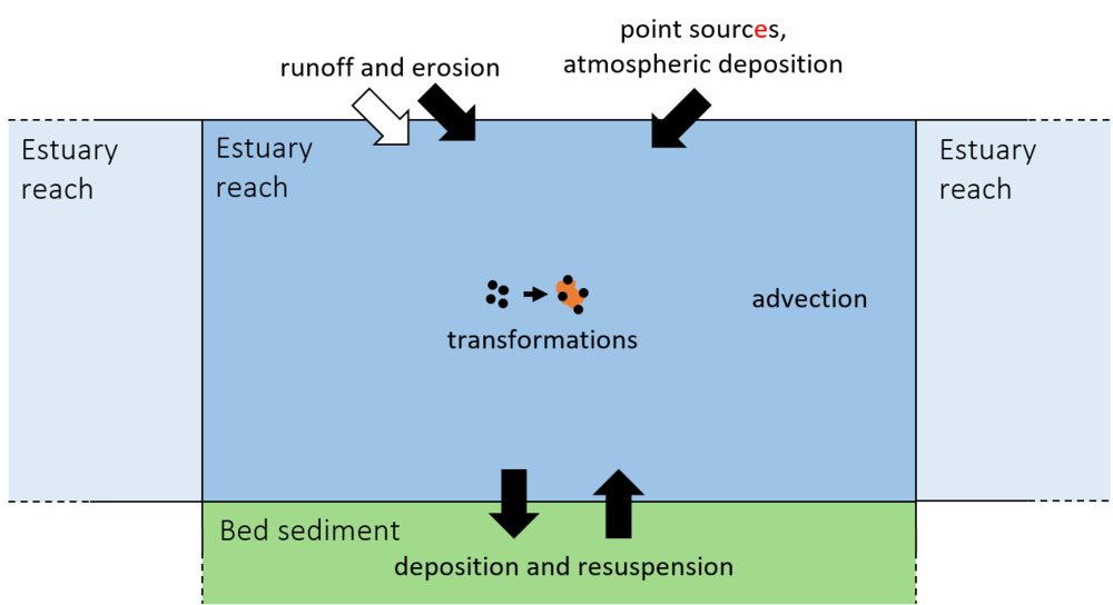
Estuaries are a key part of the environment controlling the fate of nanomaterials. The mixing of freshwater and seawater - coupled with the tidal movements - creates a rapidly changing environment within the water column in terms of the water flow, salinity (salt concentration) and suspended sediment concentrations. Within the gridded NanoFASE water-soil-organism model, estuaries are split up into a number of linked "estuary reaches", the conceptual model for which is shown below. Each reach has a bed sediment, which is documented separately.

Conceptual model of estuary reaches and their bed sediments within the NanoFASE water-soil-organism model
|
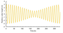
The processes transferring water, sediment and/or nanomaterial between the reaches that make up an estuary are the same as those listed for the river reach model. The main modelling difference lies in the treatment of advection (the bulk flow of the water upstream or downstream), because there is a need to simulate tide-influenced movement of water upstream and downstream. Advection is modelled by computing the volume of water within each reach every hour, and using this to compute the movement of water into and out of each estuary reach on each time step. The volume of water in each reach is computed using the theory of tidal harmonics, which allows the change in water depth at a point in an estuary over time to be calculated by considering the separate influences of the sun, moon and tidal friction on the depth of the tide over time (see diagram). Nanomaterials within each reach can undergo identical transformations to those listed for the river reach model. |
Example of computed water height (m) due to tidal forcing, for one spring-neap tide cycle
|
Read more |
Read also |
|
NanoFASE Report D2.1 Specification for the NanoFASE model |
Hardisty, J. (2007). Estuaries: Monitoring and Modeling the Physical System. Blackwell, Malden, MA, U.S.A.
|
Contact

Sam Harrison
Centre for Ecology and Hydrology (CEH)
Email: sharrison@ceh.ac.uk

